Moel Arthur
Outstanding views from the CLwydian Hills.
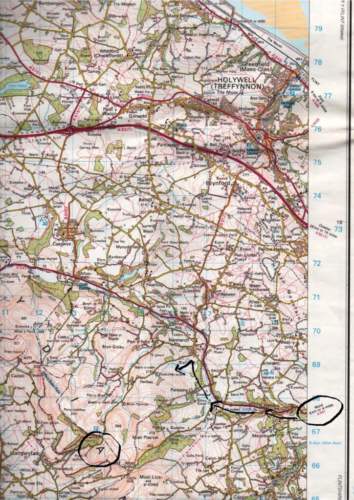
We are going to explore the hills and woods around the Pen-y-Cloddiau Iron Age hill fort.
Birds on the hills are sparse but there are some specialities such as chats and wheatear. As we amble along, we will hopefully enjoy picturesque views of the Clwydian range and Vale of Clwyd. Weather permitting of course!!!
There may be a few uneven footpaths and slight hills, and paths may become muddy after rain.
There are no facilities.
Meet at Coed Llangwyfan & Penycloddiau Car Park, near Nannerch.
Ready to depart at 9:30am.
The post code is given as CH7 5RP, BUT THIS MAY NOT take you exactly to the car park using your satnav. (It will hopefully get you close to Nannerch village at least).
So please use in conjunction with the directions below.
What3Words location: sensibly.recording.pointed
Grid reference: SJ 138 668
(N.B. This is not the Moel Arthur car park which is further to the east).
Directions:
Take Chester High Road (A540) to Two Mills. Turn right onto Welsh Road (A550) then onto A494 past Queensferry onto the A55.
Exit at Junction 33B onto A494 towards Mold.
After 1.8 miles take 1st exit onto Mold Bypass.
After 1.3 miles, at roundabout, take 5th exit into Mold. Carry straight on at next 2 roundabouts following A541, Denbigh Road.
Follow this main road for about 5.5 miles, through/past Rhydymwyn and Henre.
Just before you reach Nannerch, take left fork off main road onto Village Road towards Nannerch village centre; turn left after about 600m. NB Brown sign for Trout Fishing.
Follow this road up-hill for about 2.5 miles to car park beside the road.
I hope you can find it!
Phone me if you have any questions, issues.
Hugh
07527 828 571
